


Product Description
GPSMAP® 1042xsv Combo GPS/Fishfinder GN+ (010-01740-50)
Embark with confidence using the Garmin GPSMAP 1042xsv — a 10-inch keyed chartplotter and fishfinder combo designed for cruisers, sailors, and adventurous boaters. It blends powerful sonar, mapping, and network capabilities into one seamless, rugged unit.
- Bright 10″ WSVGA color display (1,024 × 600 px) with keypad interface and multifunction control knob, ideal when glove use or tactile feedback matters
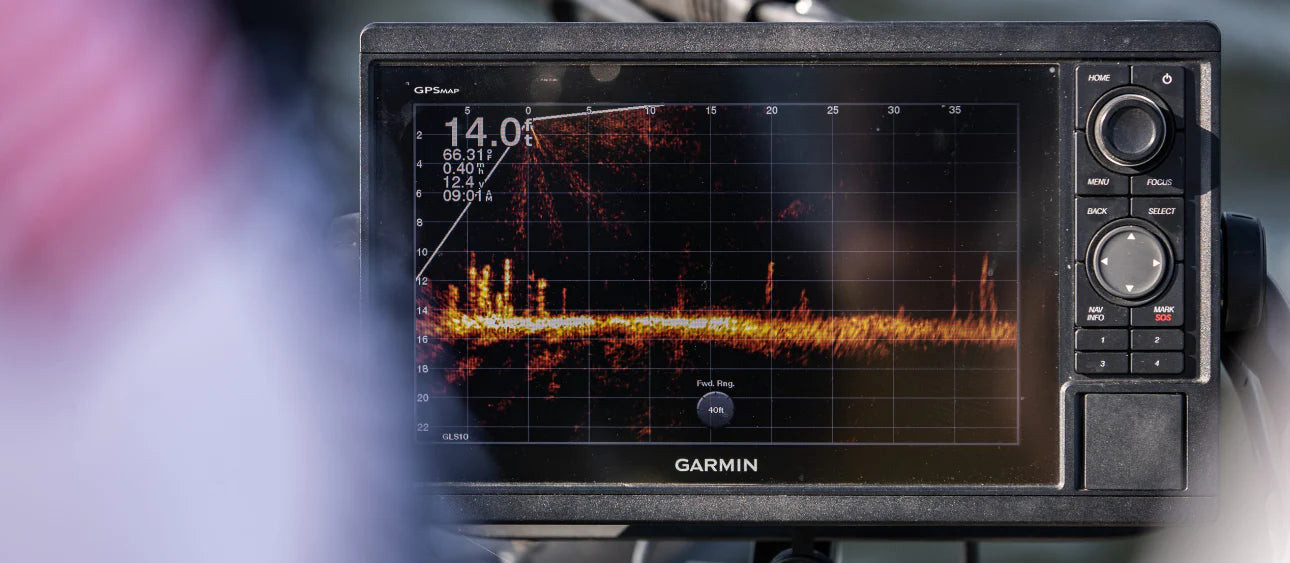
- Built-in CHIRP sonar engine supporting traditional CHIRP, CHIRP ClearVü™, and CHIRP SideVü™ scanning sonar for sharp, high-definition underwater views (transducers sold separately)
- Seamless support for Panoptix™ and LiveScope™ sonar systems (sold separately), delivering real-time, all-seeing sonar imaging to your fingertips
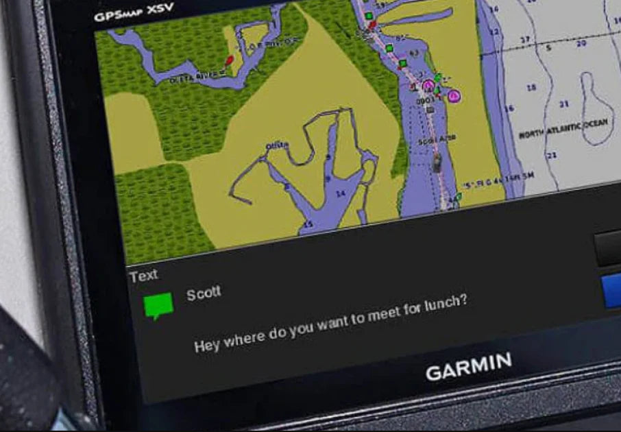
- Preloaded with Garmin Navionics+™ coastal charts and inland maps; upgradeable to Vision+™ premium charts for enhanced features
- Auto Guidance+™ route planning (for estimation only) helps suggest optimal paths based on depth and overhead clearance
- Built-in WiFi® lets you pair the chartplotter with the ActiveCaptain® app for smart notifications, software updates, OneChart™ synchronization, and community chart sharing
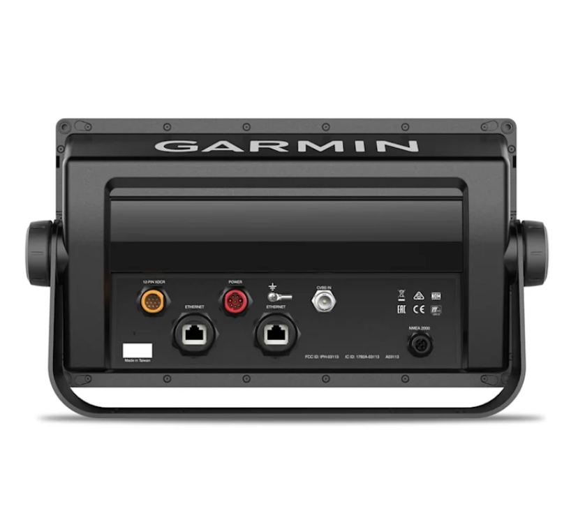
- Full Garmin Marine Network support enables sharing of sonar, charts, radar, IP cameras, and user data across multiple units
- NMEA 2000® and NMEA 0183 support ensure integration with autopilots, digital switching, weather sensors, AIS, VHF, media systems, and more
- ANT® connectivity lets you link compatible devices such as quatix® smartwatches, gWind™ Wireless 2, GNX Wind instruments, and remote controls (sold separately)
- SmartCraft® Connect gateway brings engine data into view, including RPMs, fuel flow, temperature, trim, and more (up to 4 compatible Mercury® engines)
- Create custom high-definition maps on the fly with Quickdraw™ Contours—1 ft. contour resolution—and contribute to Garmin’s Quickdraw Community for shared mapping insights
- Pre-race sailing tools via SailAssist™: laylines, virtual starting lines, enhanced wind rose, set & drift, true/apparent wind, and synchronized race timers
- High-performance positioning with internal 10 Hz GPS + GLONASS receiver, refreshing your position & heading 10 times per second to keep charts smooth and responsive
- Robust connectivity: accepts up to 5,000 waypoints, 50,000 track points, 100 routes, and dual SD card slots for additional map expansion
- Durable, marine-ready build with IPX7 waterproof rating, weighing just ~4.1 lbs (1.85 kg), and supports both bail and flush mounting options
What’s In The Box
- GPSMAP 1042xsv chartplotter
- Power/data cable
- NMEA 2000 T-connector & drop cable
- Transducer adapter (for sounder systems)
- Mounting hardware: bail mount, flush mount kit with gasket, knobs
- Protective cover and snap-on trim pieces
- Documentation & Quick start guide
- (Optional bundles may include GT52 or other transducers)
Specifications:
- Cartography Brand: Garmin Navionics+
- Screen Size: 10"
- Touchscreen: No
- Transducer Included: No
- Display Resolution: 1024x600 px


Safe payment on our website
- Choosing a selection results in a full page refresh.
- Opens in a new window.


