


Product Description
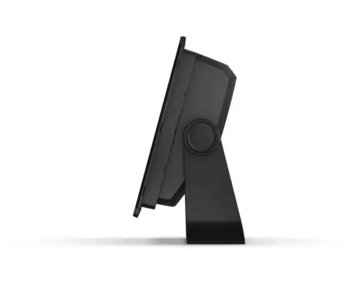
GPSMAP® 1243 12-inch Chartplotter GN+ (010-02367-60)
Elevate your helm with the Garmin GPSMAP 1243 — a premium 12-inch chartplotter engineered for advanced boaters who demand clarity, connectivity, and control.

- Crisp 12″ IPS in-plane switching touchscreen with edge-to-edge glass and slim bezels delivers exceptional sunlight readability and wide viewing angles — perfect for demanding marine environments
- High-speed 10 Hz GNSS (GPS, GLONASS, Galileo) ensures rapid, smooth positioning and up-to-date course over ground (COG) and speed tracking
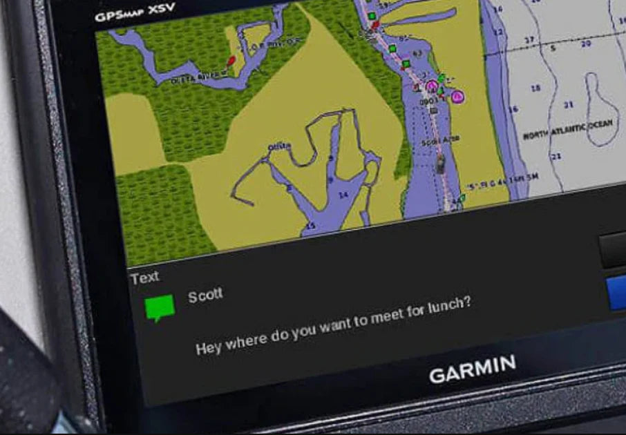
- Comes preloaded with Garmin Navionics+ coastal and inland charts, and offers Auto Guidance+™ planning routes (for planning only — always navigate safely)
- Supports Garmin Navionics Vision+™ premium chart upgrades for relief shading, satellite imagery, sonar layering, and more
- Full marine system networking via Garmin Marine Network, NMEA 2000®, NMEA 0183, J1939 (for engine connectivity), and HTML5 support
- Syncs with compatible autopilots, radar, cameras, and marine audio/video gear, making it a central hub of your onboard electronics
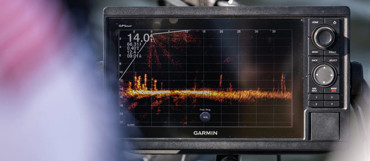
- Add FrontVü™ forward-looking sonar (sold separately) to help detect underwater obstacles — though effectiveness is reduced at speeds above ~8 knots
- Integrated ANT® connectivity lets you pair with quatix® smartwatches, wireless remotes, gWind™ Wireless 2 transducers, and other ANT devices
- Built-in Wi-Fi® enables real-time pairing with the free ActiveCaptain® app to access OneChart™, smart notifications, software updates, and community chart layers
- Garmin SailAssist™ features (requires compatible wind transducer) support laylines, race start guidance, set & drift, wind data overlays, wind rose, and polar performance charts
- OneHelm™ feature merges operations from compatible third-party devices (e.g. EmpirBus™ digital switching) into a unified interface
- Slim, low-profile chassis and reduced footprint allow easier retrofit installations across dashboards
Includes in box: chartplotter unit, preinstalled microSD card, power cable, NMEA 2000 T-connector and drop cable, bail mount with knobs, flush mounting kit with gasket, protective cover, trim snap covers, and documentation
Note: This variant (010-02367-60) is the mapping-only version (does not include internal sonar). For sonar integration, optional external sounders or the xsv version may be considered.
Specifications:
- Cartography Brand: Garmin Navionics+
- Internal/External Antenna: Internal
- Screen Size: 12"
- Touchscreen: Yes
- Display Resolution: 1280 x 800 px


Safe payment on our website
- Choosing a selection results in a full page refresh.
- Opens in a new window.


