


Product Description
GPSMAP® 743 7-inch Chartplotter GN+ Non-sonar with Mapping (010-02365-60)
Take command of your vessel’s helm with the advanced Garmin GPSMAP 743 Chartplotter GN+, engineered for marine enthusiasts seeking elite performance, connectivity, and precision navigation. This 7-inch high-resolution chartplotter delivers sharp visuals, powerful processing, and seamless integration into modern boat systems — ideal for both coastal excursions and inland waterways.
Key Features & Capabilities
- Higher-resolution 7″ IPS touchscreen display with 60% more pixels than previous-generation models, boosting sunlight readability and clarity.
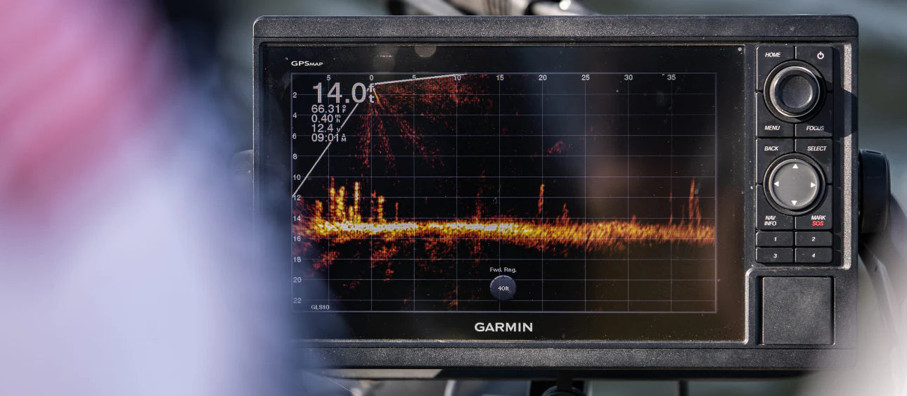
- Fast, responsive processing with nearly double the power of previous units and a 10 Hz GNSS receiver (GPS + GLONASS + Galileo) for smooth, accurate speed, course over ground (COG) and position data.
- Sleek, slim-line design featuring edge-to-edge glass and reduced footprint — perfect for retrofit into a wide range of dash configurations.
- Preloaded with Garmin Navionics+™ coastal charts and inland mapping; features the Auto Guidance+™ planning tool (note: for planning only, not a substitute for safe navigation). Supports optional Garmin Navionics Vision+™ premium map content for enhanced detail.
- Built-in SailAssist™ suite for racing and sailing — including laylines, set & drift, wind data and more — when paired with a compatible wind transducer (sold separately).
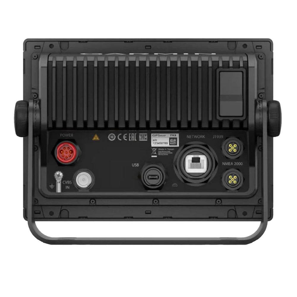
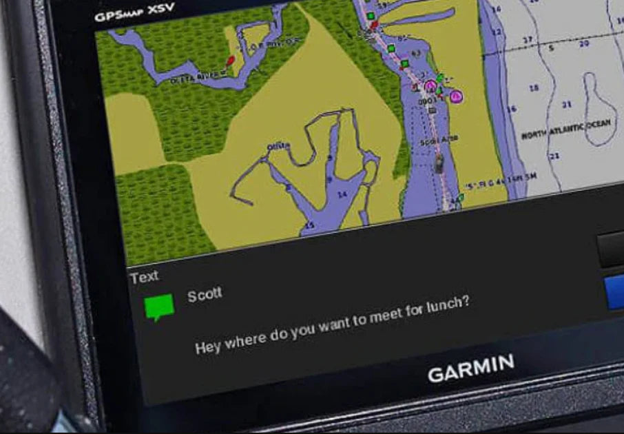
- Extensive networking: Connect sonar, autopilots, radar, cameras and multimedia via HTML 5.0 interface, NMEA 2000®, NMEA 0183, J1939 for engine data, and the Garmin Marine Network. Also supports built-in Wi-Fi to pair with the free ActiveCaptain® smartphone app for OneChart™, smart notifications, and software updates.
- ANT® wireless connectivity for compatible devices including quatix® marine smartwatches, gWind™ Wireless 2, GNX™ Wind instrument, wireless remote controls (sold separately). That means remote monitoring & control from your wrist or remote input device.
- Engine and system integration: J1939 engine connectivity plus the exclusive OneHelm™ feature enables connection to third-party devices and digital switching systems like EmpirBus™.
- Durable build: Dimensions 7.6″ × 5.5″ × 2.9″ (19.2 × 14.0 × 7.4 cm), weight approx. 2.8 lbs (1.3 kg), water rating IPX7 for reliable marine performance.
- Memory and mapping capability: Accepts two microSD™ cards, supports up to 5,000 waypoints, 50,000 track points and 50 saved tracks; capable of storing 100 navigation routes.
What’s Included In The Box
- Chartplotter unit
- microSD card preinstalled
- Power cable
- NMEA 2000 T-connector
- NMEA 2000 drop cable
- Bail-mount kit with knobs
- Flush-mount kit with gasket
- Protective cover
- Snap-on trim piece covers
- Documentation and installation guide
Why Choose the GPSMAP 743 for Your Helm?
- Whether you’re cruising coastal waters or navigating inland lakes, the combination of Navionics+ mapping and Auto Guidance+ gives you intelligent planning and course prediction without sacrificing safety.
- The 10 Hz high-sensitivity receiver ensures that even when maneuvering at higher speeds, you’ll get smooth tracking and accurate data—not lag or choppy positioning.
- The full integration into networks (NMEA 2000/0183, J1939, WiFi, ANT) means your helm becomes a connected control hub — radar, sonar, cameras, autopilot and engine connectivity all flow into one display.
- Upgrading your helm? The slimline design, edge-to-edge glass, and compact footprint make it easier to fit into modern dash layouts and save space.
- For sailors and racers, the included SailAssist features elevate your wind and navigation tools; for tech-savvy users, the built-in wireless and app connectivity adds smart features such as notifications, updates, and control.
- Garmin support and accessory ecosystem ensure future expandability — sonar modules, radar, external monitors and networked systems can be added as your boat evolves.
Ideal For
- Recreational boaters who want a professional-grade 7″ chartplotter with premium features and mapping right out of the box.
- Sailors requiring layline and wind drift tools onboard.
- Powerboat owners building a fully networked helm system — autopilot, engines, cameras, radar, sonar and mobile-app control.
- Retrofit projects where you need a compact chartplotter that still packs maximum connectivity and mapping power.
Quick Specs At-a-Glance
- Screen size: 7″ (6.1″ × 3.5″ visible area) diagonal 17.8 cm
- Resolution: 1024 × 600 pixels
- Power input: 10-32 V DC, typical draw ~1.1 A at 12 V DC, max ~1.5 A
- Waypoints/tracks/routes: 5,000 / 50,000 / 100 respectively
- Networking: 1 × NMEA 2000, 1 × NMEA 0183, 1 × BNC video input, 1 × Garmin Marine Network port, WiFi & ANT+ wireless.
- 0100236560
WARNING: This product can expose you to chemicals which are known to the State of California to cause cancer, birth defects or other reproductive harm. For more information go to P65Warnings.ca.gov.


Safe payment on our website
- Choosing a selection results in a full page refresh.
- Opens in a new window.


