


Product Description
GPSMAP® 8610 10 inch Chartplotter GN+ (010-02091-50)
You’re a mariner who demands performance, flexibility, and full control of your onboard systems. The GPSMAP 8610 Chartplotter GN+ delivers all this and more — whether cruising, racing, fishing, or exploring. Below are the standout features and capabilities that set it apart:

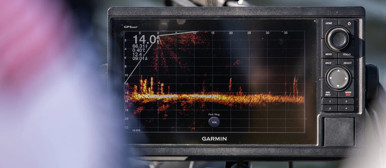
- 10″ full HD IPS touchscreen — with WUXGA 1920 × 1200 resolution for crisp maps and instrument displays, wide viewing angles, and excellent readability even under bright sun or when wearing polarized sunglasses
- Sleek mounting options — install multiple displays edge-to-edge for a modern “glass helm” look, or flush/bail mount for custom helm layouts
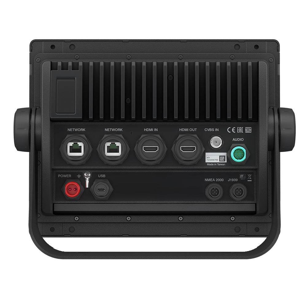
- Advanced connectivity & networking — built-in NMEA 2000 and Garmin Marine Network support lets you integrate radar, autopilot, cameras, instruments, and more across all displays
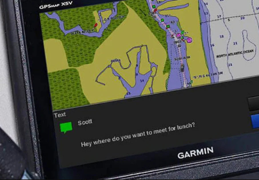
- Wireless integration via ANT & Wi-Fi — pair with quatix® smartwatches, gWind™ Wireless 2, remote controls, and access ActiveCaptain® app features like OneChart™, smart notifications, and firmware updates
- OneHelm™ third-party control — centralize control of EmpirBus digital switching, lighting systems, stabilization gear, and other compatible third-party devices — all from the chartplotter screen
- Preloaded Garmin Navionics+ cartography — includes coastal and inland mapping for U.S. & Canada, with Auto Guidance+™ (for planning) built in. Supports optional upgrade to Vision+™ premium charts
- Premium-performance processor — ensures fast map redraws, fluid operation of high-bandwidth tasks like video distribution or heavy network loads
- SmartMode™ presets — set up one-touch profiles for docking, cruising, fishing, anchoring, or racing — switching modes adjusts displays, input sources, and data layouts instantly
- SailAssist™ & prerace tools — tailored for sailboats and racers, you’ll get wind-angle data, optimized course overlays, and race start guidance
- Mercury engine data support — via SmartCraft® Connect, monitor RPMs, fuel flow, temperature, trim and more for up to four Mercury engines
- Dual microSD® slots — two card slots allow simultaneous use for chart/data storage and ActiveCaptain sync or map updates

What’s Included in the Box
Chartplotter, power cable, NMEA 2000 T-connector, drop cable, bail mount with knobs (8600/8610 series), flush mount kit, protective cover, trim snap covers, and documentation.
Technical & Environmental Specs
- Dimensions: 10.25″ × 8.0625″ × 2.95″ (25.9 × 20.5 × 7.5 cm)
- Weight: ~5.2 lb (2.4 kg)
- Waterproof rating: IPX7 (can withstand immersion up to 1 m for 30 min)
- Operating temperature: –15 °C to 55 °C (5 °F to 131 °F)
- Power input: 10–32 Vdc, typical draw ~1.5 A at 12 V
- Memory card compatibility: up to 32 GB microSD (two slots)
- Navigation receiver: internal 10 Hz GPS/GLONASS/Galileo
Bonus Capabilities & Tips
- Holds up to 5,000 waypoints, 100 routes (each with up to 254 legs), and 50,000 track points across multiple tracks
- Works seamlessly with ExpertGPS or EasyGPS to upload/download waypoints, routes, tracks, or import from Google Earth/CAD/GIS sources
- Firmware updates enhance usability: e.g. better chart contrast, improved Auto Guidance+, sonar voice commands, radar overlays, and preferred source filtering


Safe payment on our website
- Choosing a selection results in a full page refresh.
- Opens in a new window.


