


Product Description
GPSMAP® 8616 16-inch Chartplotter GN+ (010-02093-50)
Experience next-level marine navigation and charting power with the Garmin GPSMAP 8616 Chartplotter GN+ — a feature-packed 16" multifunction display built for serious mariners.
The easy-to-use, easy-to-install chartplotter/sonar combo delivers MFD performance in a combo-size package.

- Vivid 16″ Full HD IPS touchscreen — delivers wide viewing angles, crisp clarity, and sunlight readability even with polarized sunglasses.
- Preloaded Garmin Navionics+ coastal & inland charts — includes Auto Guidance+™ (for route planning) and supports optional Navionics Vision+ premium map upgrades.
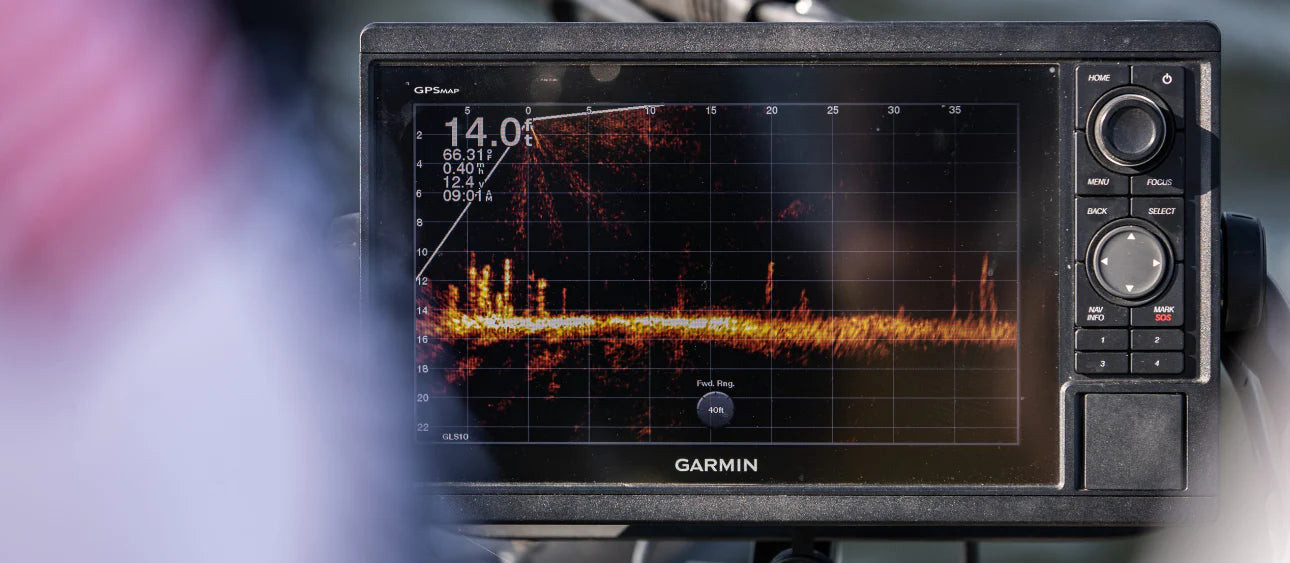
- Ultimate sonar support — works seamlessly with Garmin’s full sonar line: CHIRP traditional, ClearVü™, SideVü™, Ultra High-Definition scanning sonar, LiveScope™, and additional live sonar solutions (transducers sold separately).
- Seamless marine networking — with NMEA 2000® and Garmin Marine Network, integrate radar, autopilot, cameras, sensors, instruments, and multimedia across multiple displays.
- Smart connectivity — ANT® and Wi-Fi® let you pair with quatix® smartwatches, gWind™ Wireless 2 sensors, and more.
- SmartCraft® Connect compatibility — monitor RPMs, fuel flow, temperature, trim, etc., for up to four compatible Mercury® engines.
- OneHelm™ control hub — centralized interface on your chartplotter for third-party device control (lighting, stabilization, digital switching).
- SmartMode™ station presets — one-touch toggles for docking, cruising, fishing, anchoring, and more for quicker situational transitions.
- Built-in SailAssist™ features — get prerace guidance including laylines, wind roses, true wind data, course-over-ground, synchronized race timer, and virtual starting lines.
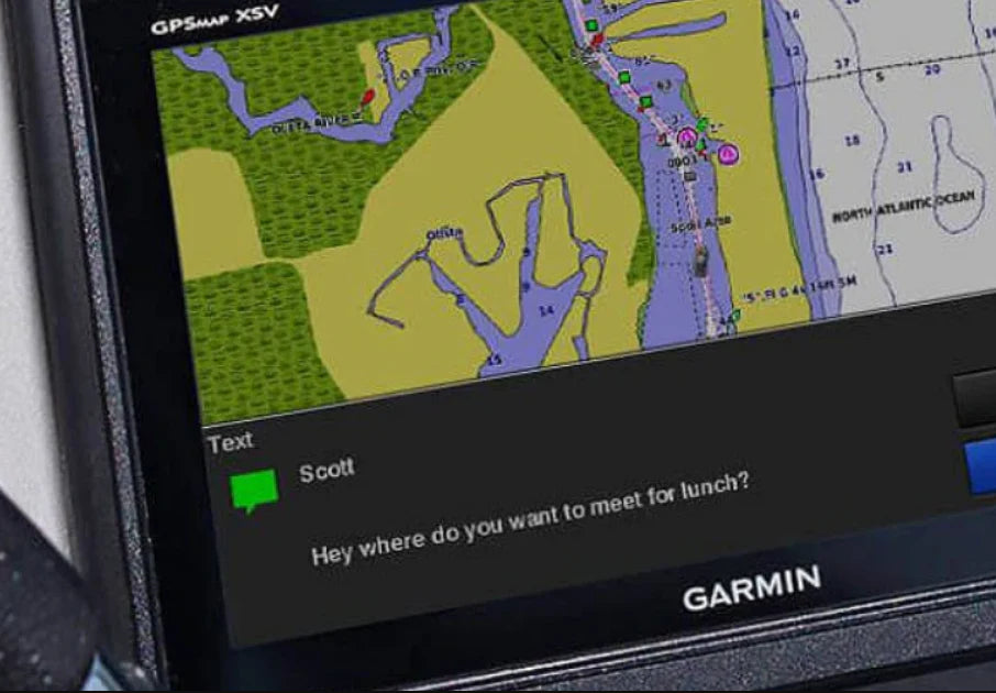
- ActiveCaptain® integration — via built-in Wi-Fi, manage your marine setup remotely: updating maps, planning trips, smart notifications, and OneChart™ map syncing.
- Dual microSD™ slots — expand mapping and data storage (up to 32 GB each) without compromising performance.
- Flexible mounting & aesthetic helm design — mount flush or flat, edge-to-edge with other displays for a sleek, glass-helm look.

Box Includes:
Chartplotter unit, power cable, NMEA 2000 T-connector, NMEA 2000 drop cable, flush mount kit, protective cover, trim snap covers, user documentation.
Technical Highlights You Should Know:
- Dimensions: approximately 15.1" × 10.3" × 3.0" (38.5 × 26.3 × 7.6 cm)
- Weight: ~9.6 lbs (4.4 kg)
- Power input: 10 – 32 V DC, typical draw ~1.3 A (max ~6.0 A)
- Operating temperature: –15 °C to 55 °C (5 °F to 131 °F)
- Water resistance: rated to IPX7 (can endure immersion in 1 m for up to 30 mins)
- Receiver: 10 Hz GPS / GLONASS / Galileo
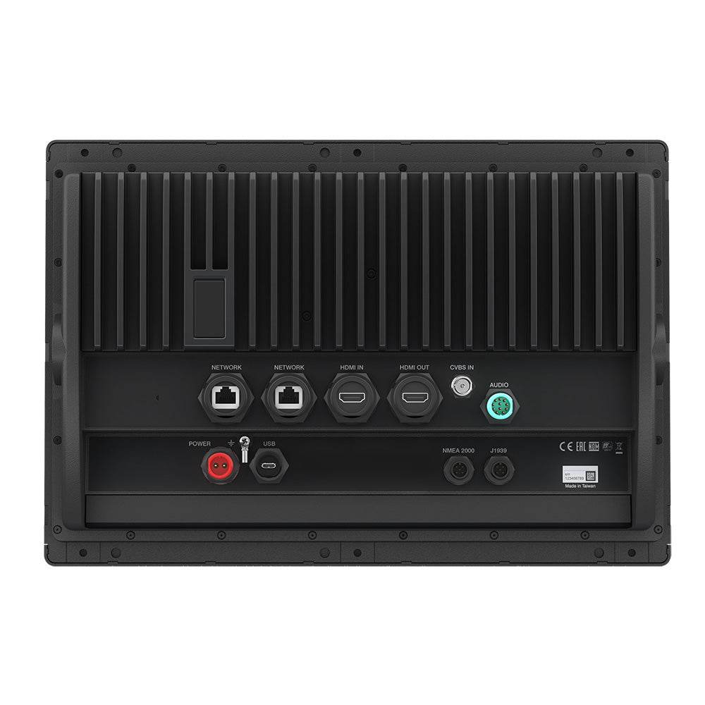
- Connectors: 2 Garmin Marine Network ports, NMEA 2000, HDMI in/out, BNC video in, NMEA 0183, USB, J1939, audio out


Safe payment on our website
- Choosing a selection results in a full page refresh.
- Opens in a new window.


