


Product Description
GPSMAP® 1022xsv 10-inch Keyed Networking Combo Worldwide (No Transducer) (010-01740-02)
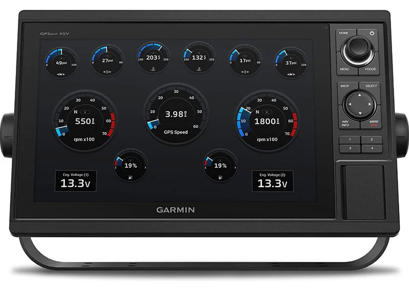
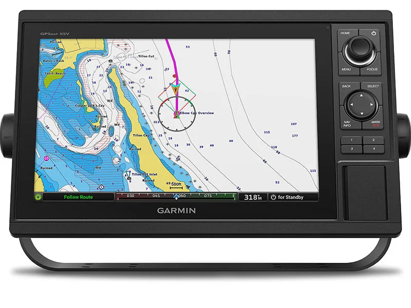
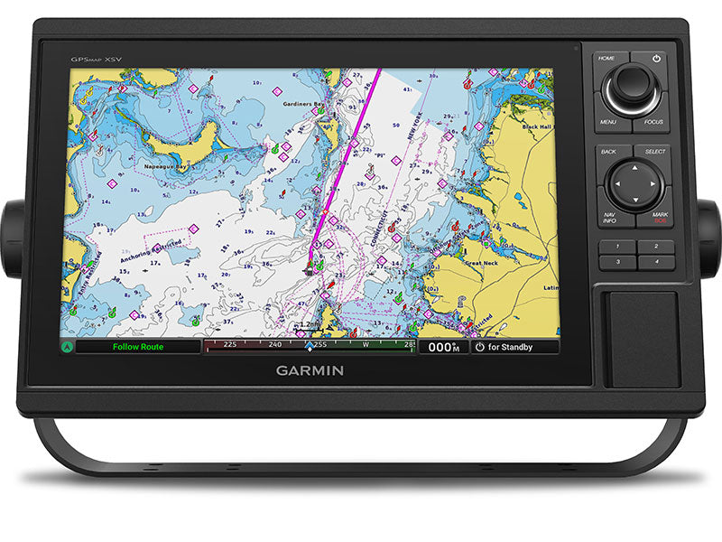
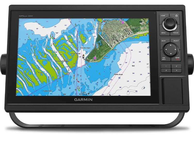
This chartplotter features a large, bright screen coupled with quick and easy-to-use keypad interface with user-programmable keys and multifunction control knobs to help you navigate with ease.
- Experience full chartplotter/sonar integration with the 10-inch keyed display and multifunction knob for intuitive control—even in bright sunlight
- Navigate with confidence using the high-sensitivity 10 Hz GPS/GLONASS receiver, which refreshes position and heading 10 times per second for buttery smooth map movement
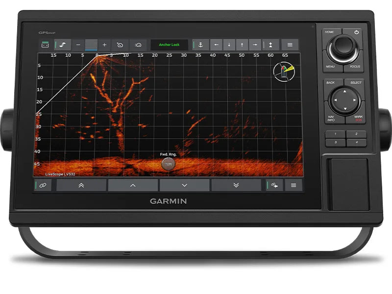
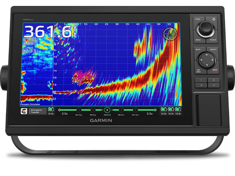
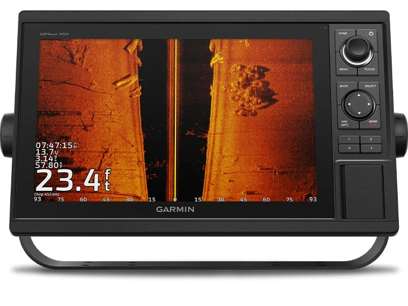
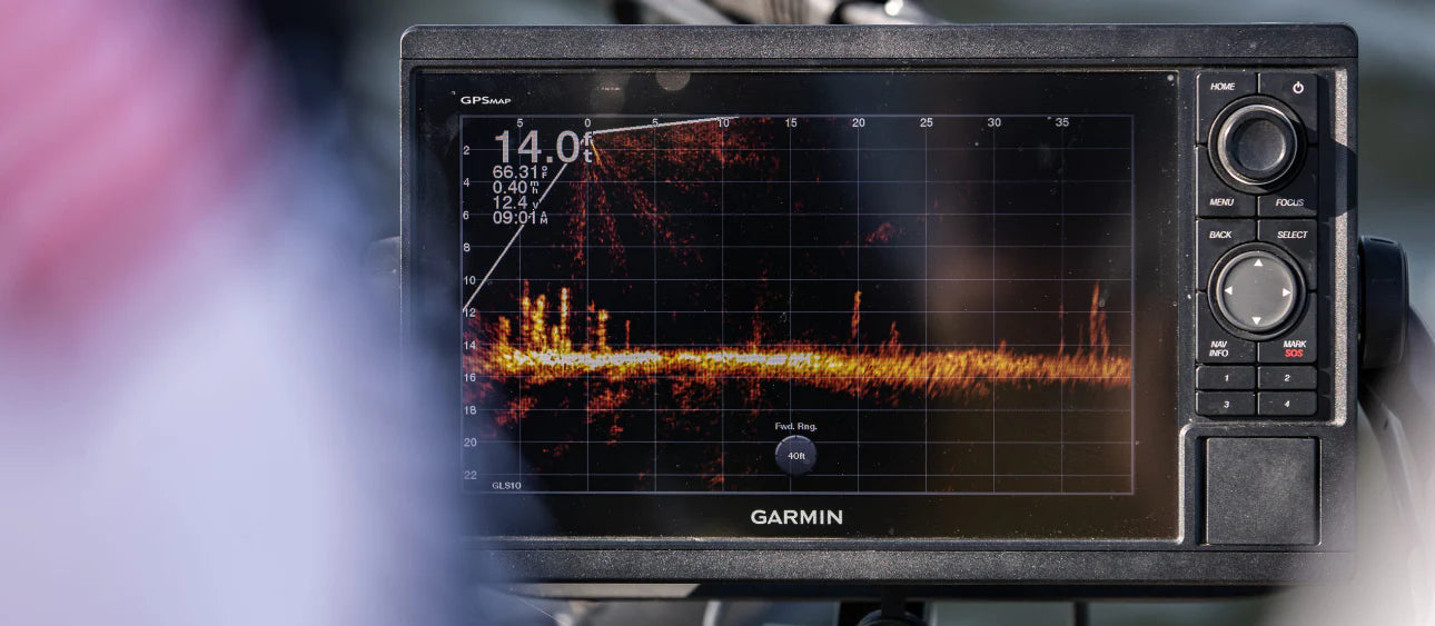
- Built-in sonar capabilities include single-channel CHIRP, CHIRP ClearVü, and CHIRP SideVü scanning sonar — ready out of the box (just add compatible transducers)
- Supports Panoptix all-seeing sonar and premium Garmin sonar modules for advanced underwater imaging (transducers sold separately)
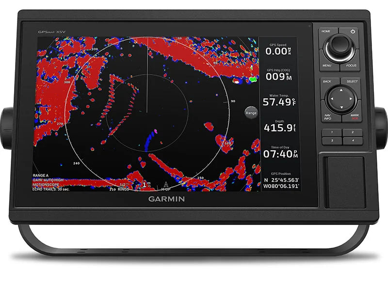
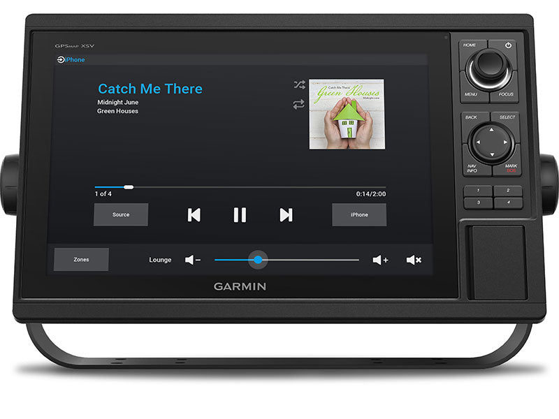
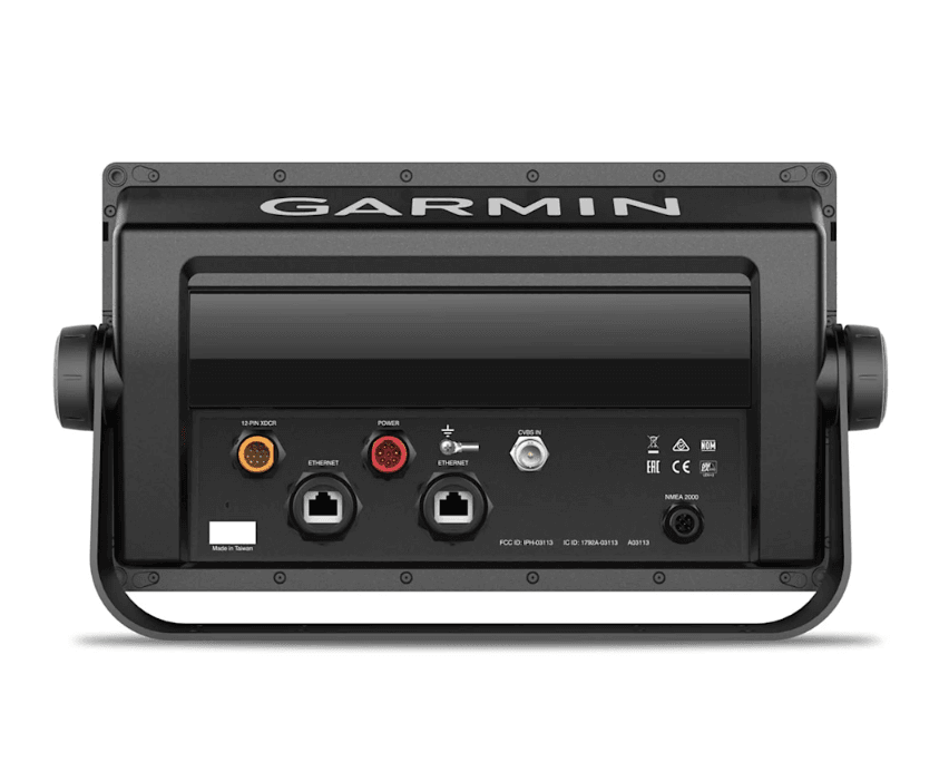
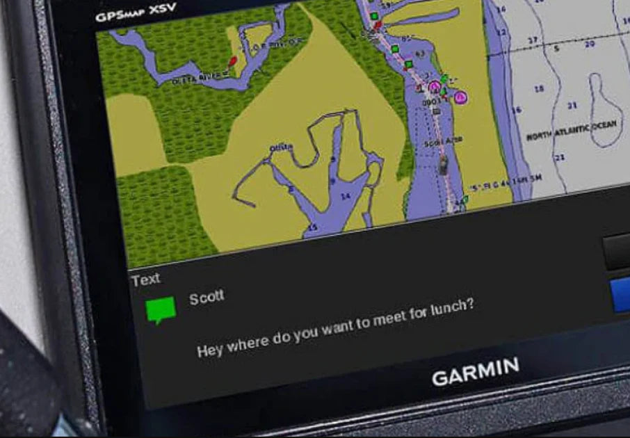
- Fully network capable: share sonar, maps, radar, IP cameras, user data across multiple displays using Garmin Marine Network; plus it supports NMEA 2000 and NMEA 0183 for autopilots, AIS, weather, VHF, engine data
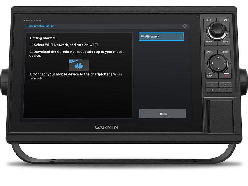
- Built-in Wi-Fi connects to Garmin’s ActiveCaptain™ app — plan routes, download maps, sync with your chartplotter, and receive smart notifications seamlessly
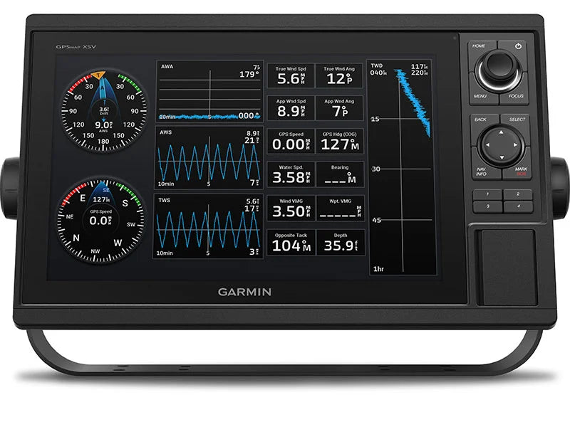
- ANT+ wireless connectivity lets you pair with quatix® marine watches, gWind™, GNX Wind instruments, wireless remotes and more
- Quickdraw Contours lets you draw and save your own 1-ft resolution HD fishing maps, fully customizable and shareable with the Garmin community
- SailAssist features provide race-ready functionality: virtual starting line, laylines, drift and set, true/apparent wind data (sensors required)
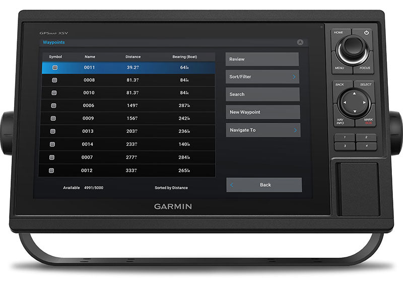
- Import waypoints, tracks, routes in GPX format from other devices or manufacturers — seamless transition
- Expand your map options with dual SD card slots for LakeVü, BlueChart®, Navionics+, Vision+ and more
- Rugged and reliable: IPX7 waterproof rating, operating temperature from –15 °C to 50 °C, and a durable build of polycarbonate and die-cast aluminum
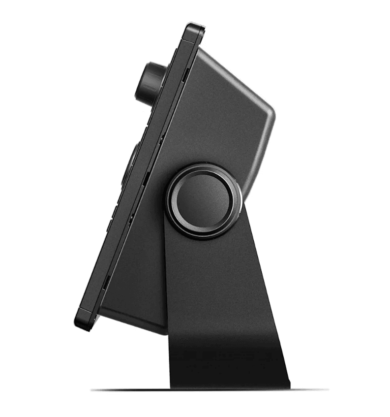
- Compact but powerful: measures 12.5" × 7.3" × 2.7", weighs ~4.1 lbs, pulls typical current 1.9 A at 12 V (max 2.7 A)
- In the box: chartplotter unit, power/data cable, NMEA 2000 T-connector & drop cable, 8-pin to 12-pin adapter, bail & flush mount kits, protective cover, trim covers, documentation
- Electrical: 10–32 Vdc input, 1 kW sonar output, 2 Garmin Marine Network ports, 1 video input (BNC), support for Fusion-Link™, AIS, DSC, smart device remote control, engine data integration
Specifications:
- Cartography Brand: Garmin
- Included Transducer: Not Included
- Screen Size: 10"
- Touchscreen: No
- Transducer Included: No
- Display Resolution: 1024x600 px
Quick Guide (pdf)
Owner's Manual (pdf)


Safe payment on our website
✔ Verified Reviews
- Choosing a selection results in a full page refresh.
- Opens in a new window.