


Product Description
GPSMAP® 8412xsv 12" Chartplotter/Sounder Combo with Worldwide Basemap & Sonar (010-02092-02)
- Stunning 12″ Full HD IPS Touchscreen – The GPSMAP 8412xsv features a 1920×1080 FHD in-plane switching display for wide viewing angles and excellent readability even under bright sunlight or with polarized sunglasses.
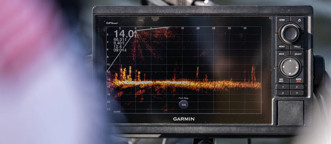
- All-in-One Chartplotter & Sonar System – Includes a built-in support for dual-channel 1 kW traditional CHIRP sonar, CHIRP ClearVü and CHIRP SideVü scanning modes, plus support for Ultra High-Definition scanning sonar—no external “black box” required.
- Panoptix / Live Sonar Ready – Seamlessly integrate Panoptix all-seeing sonar (transducers sold separately) to view live underwater action around your vessel.
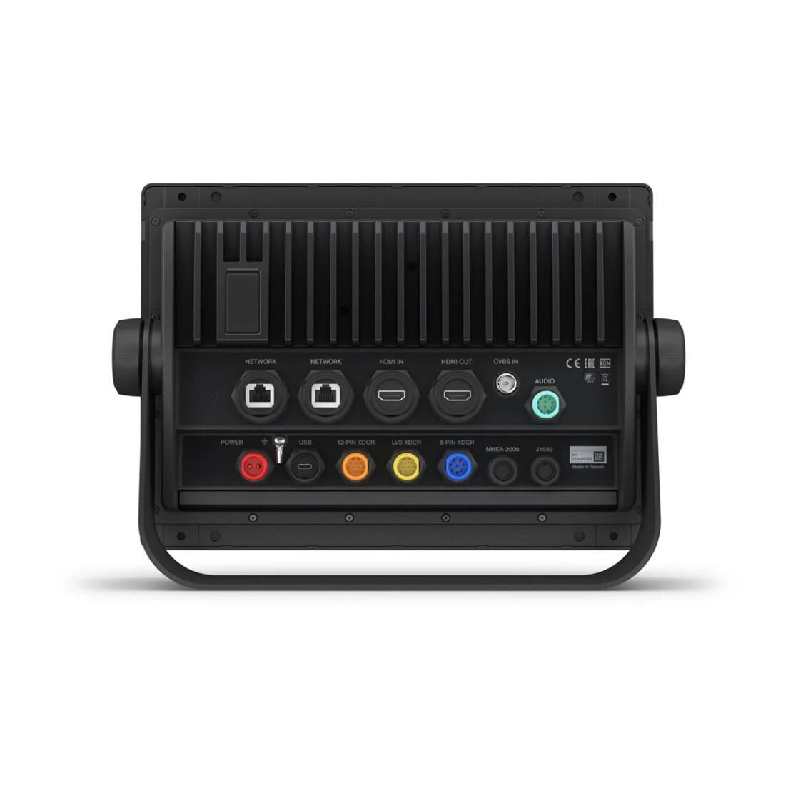
- Professional Networking & Connectivity – Fully network capable with NMEA 2000®, Garmin Marine Network, plus support for NMEA 0183. Share radar, autopilot, cameras, instruments, and forward-looking sonar across multiple displays.
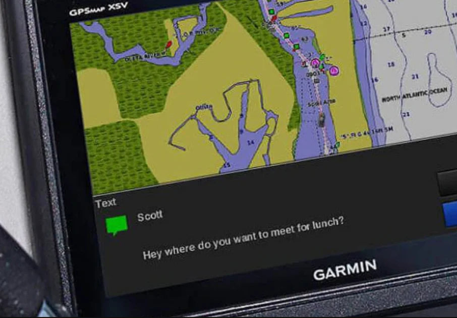
- Wireless Integration (Wi-Fi, Bluetooth & ANT) – Pair with the free ActiveCaptain® app via onboard Wi-Fi to enable OneChart™, software updates, smart notifications, and Garmin Quickdraw™ community mapping. Bluetooth and ANT support connects to quatix® marine watches, wireless remote controls, gWind™ Wireless 2, VIRB® action cams, and more.
- SmartMode™ Station Controls – Reduce clutter and streamline operations: consolidate networked sonar, radar, media, and digital switching into a single, one-touch interface—especially helpful during critical maneuvers like docking.
- Advanced Sailing Tools – Access Garmin SailAssist™ features including prerace guidance, laylines, wind rose, true and apparent wind data, tide/current sliders, course-over-ground lines, drift & set, and customizable gauge displays.
- Preloaded Worldwide Basemap & Expandable Charts – Comes with global basemap coverage. Add premium chart services like Garmin/Navionics+ or Vision+ for detailed coastal, inland, and bathymetric maps.
- Robust Marine Build & Mounting Options – Measures approx. 11.9″ × 8.5″ × 3″, weighs ~6.2 lb, and carries an IPX7 water-resistance rating. Choose between bail, flush, or flat-edge mounting to suit your helm’s aesthetic.
- High Data Capacity & Navigation Storage – Supports 5,000 waypoints, 50 saved tracks, and track logs up to 50,000 points. Includes dual microSD card slots for expanded map storage.
- Versatile Video & Camera Inputs – Features HDMI and composite video input/output to display external video sources (e.g. underwater cameras) directly on the chartplotter’s screen.
- Efficient Power Use – Powered by 10–32 V DC, typical draw ~1.3 A at 12 V, with a peak draw of ~6 A.
Specifications:
- Included Transducer: Not Included
- Cartography Brand: Garmin
- Transducer Included: No
- Touchscreen: Yes
- Screen Size: 12"


Safe payment on our website
✔ Verified Reviews
- Choosing a selection results in a full page refresh.
- Opens in a new window.