


Product Description
GPSMAP® 923 9-inch Non-Sonar with Worldwide Basemap (010-02366-00)
GET A SHARPER VIEW FROM YOUR CONNECTED HELM
Experience a new level of marine navigation with the GPSMAP® 923 9-inch Non-Sonar with Worldwide Basemap (0100236600)—a powerful, connected helm display built to integrate seamlessly into your marine electronics suite.
- With 50 % more touchscreen pixels and nearly double the processing power over the prior-generation 9″ units, you get a super crisp, responsive interface for charts and system integration
- The high-resolution IPS display delivers improved sunlight readability and excellent viewing from any angle—ideal for bright boating environments
- Its slim, edge-to-edge glass design and reduced footprint simplify retrofit installation into tighter dash configurations
- Garmin SailAssist™ features empower sailors with laylines, race start guidance, enhanced wind rose, true wind, set & drift, wind speed/angle, tide/current sliders, and more
- Use optional BlueChart® G3 Vision® or Navionics® Vision+ charts to unlock Auto Guidance, satellite imagery, and advanced routing features
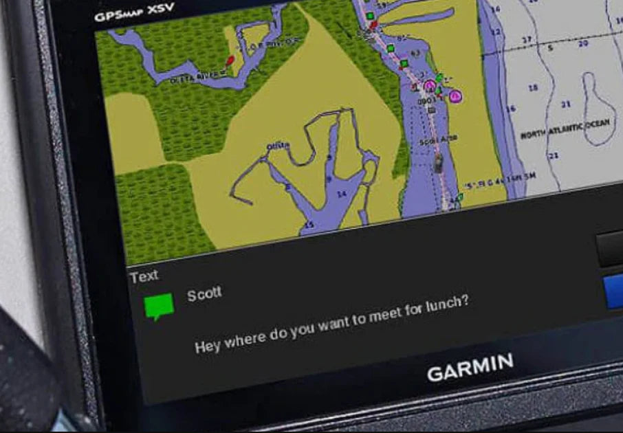
- Via Garmin Marine Network, you can share maps, waypoint data, radar, and camera video across multiple devices onboard
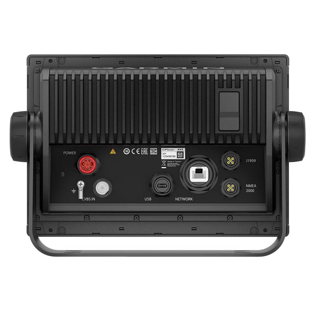
- Full support for NMEA 2000® and NMEA 0183 lets you connect autopilots, weather, AIS, VHF, digital switching, and more—control many systems from one screen
- Wi-Fi built in enables seamless pairing with the ActiveCaptain® app to access OneChart™, smart notifications, community maps (Quickdraw™), firmware updates, and Garmin Helm switching
- Integrated ANT® technology supports wireless connection to quatix® watches, gWind™ sensors, GNX™ Wind instruments, or remote controls
- J1939 engine connectivity extends support to select Yamaha (and other compliant) engines
- Use the exclusive OneHelm™ digital switching to combine controls of third-party systems (like EmpirBus™) into one unified interface
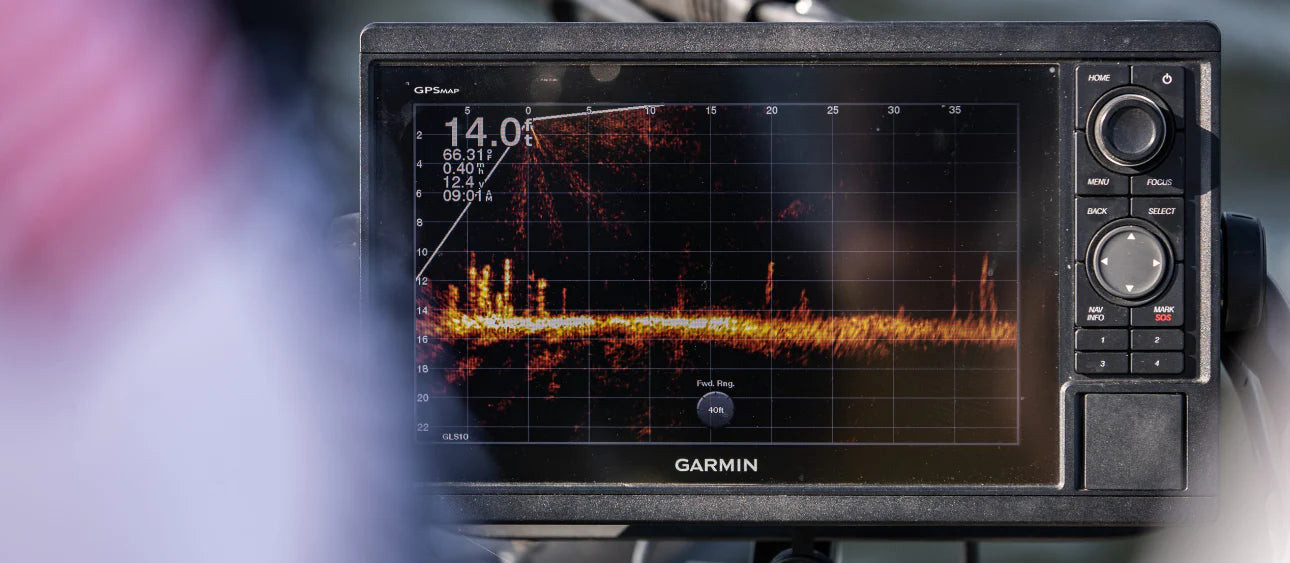
- Panoptix™ sonar-compatible (e.g. pair with a PS51 transducer—sold separately) enables live, forward-looking obstacle detection at up to ~300 ft range
Physical & system specifications:
- Dimensions: ~9.2″ × 6.4″ × 3.0″ (23.3 × 16.2 × 7.6 cm)
- Display resolution: 1280 × 720 px (WXGA)
- Weight: 3.6 lbs (1.6 kg)
- Power draw: up to 22 W at 10 Vdc (typical 1.3 A / max 1.8 A at 12 Vdc)
- Water rating: IPX7 (protected against immersion to 1 m for 30 mins)
- Mount options: bail, flush, or flat mounting
- Internal or external antenna via NMEA 2000 compatibility
- Waypoints capacity: 5,000
- Track log: 50,000 points, 50 saved tracks
- Routes: up to 100
- Preloaded worldwide basemap, with available upgrades to premium chart options
- Supports Garmin radar, external sonar (black-box), smart-mode presets, AIS, DSC, Fusion-Link audio systems
What’s in the box:
GPSMAP 923 chartplotter, preinstalled microSD card, power cable, NMEA 2000 T-connector, 2 m NMEA 2000 drop cable, bail mount kit with knobs, flush mount kit with gasket, protective cover, trim snap covers, documentation
With its powerful processing, high-definition display, network connectivity, and advanced sailing tools, the Garmin GPSMAP 923 is more than a chartplotter—it’s the hub of your onboard navigation ecosystem.
Specifications:
- Cartography Brand: Garmin
- Internal/External Antenna: Internal
- Screen Size: 9"
- Touchscreen: Yes
WARNING: This product can expose you to chemicals which are known to the State of California to cause cancer, birth defects or other reproductive harm. For more information go to P65Warnings.ca.gov.


Safe payment on our website
✔ Verified Reviews
- Choosing a selection results in a full page refresh.
- Opens in a new window.